Content to be available soon.
Email:
info@acdep.org
Phone:
037 202 3245
ACDEP Financial Services
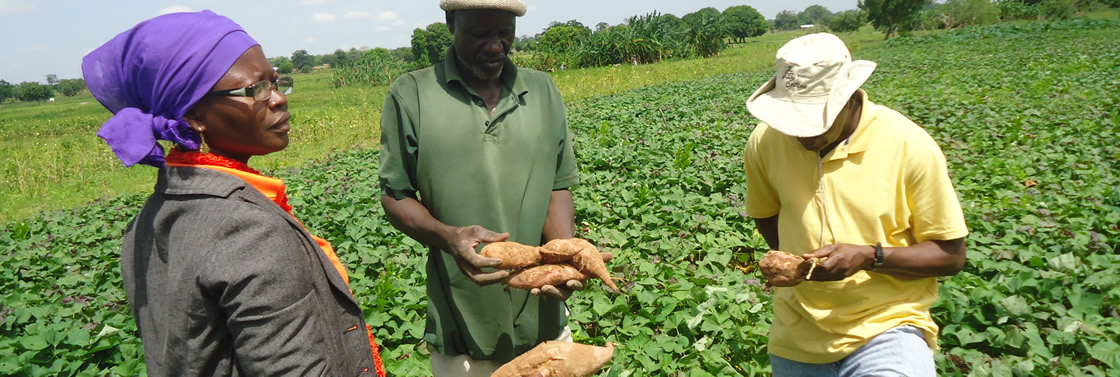
This project provides a model for facilitating and increasing access to credit and other financial services from banks by rural smallholder farmers, processors and other rural entrepreneurs.

Health Projects
The health unit supports Primary Health Care Programmes to reach out to communities in new and innovative ways, exploring the use of communities own resources and capabilities
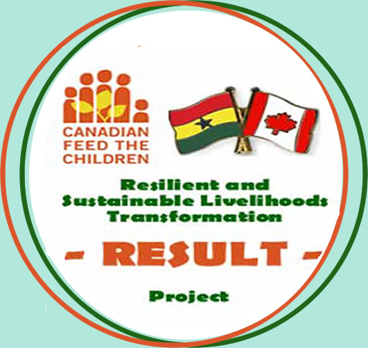
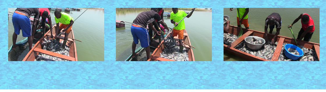
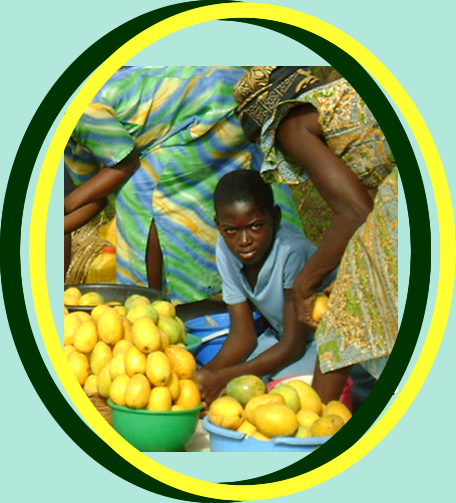
The RESULT Project
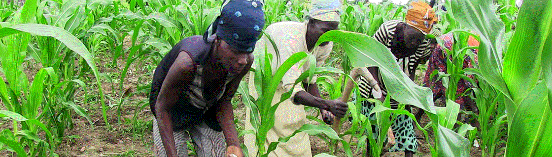
The Project addresses the four basic elements of food security by increasing food availability, access, utilization and stability (i.e. resilience).
Description
Upper East Region (pop 1,046,545) is located in the north-eastern corner of the country. The capital city is Bolgatanga, known commonly as 'Bolga'. It is bordered to the north by Burkina Faso, the east by the Republic of Togo, the west by Sissala in Upper West and the south by West Mamprusi in Northern Region. The land is relatively flat with a few hills to the East and southeast. The total land area is about 8,842 sq km, which translates into 2.7 per cent of the total land area of the country.
It is divided into 10 districts, although the centre of the population is clustered in Bolga. The region is 80% rural agrarian.
(Source: wikipedia)
3182
| Title | Description | Location Type |
|---|---|---|
| Presbyterian Health Service - North |
In downtown Bolgatanga, serving as a central office headquarters. |
populated place |
| Sandema Agric Station |
Outside of Bolgatanga in the Builsa District, Sandema PPHC, the Sandema Agric Station, and the Community Rehabilitation Centre, are clustered in one area. |
Station |
| Zorko Clinic |
In the community of Zorko, approx. 1 hour's drive from Bolgatanga. |
Health Facility |
| Namolgo Presbyterian Clinic |
The clinic serves the Namolgo community, approximate one hour's drive from Bolgatanga. |
Health Facility |
| Presbyterian Primary Health Centre - Bolga |
The PPHC in central Bolgatanga has clinic and eye health facilities. |
populated place |
| Presbyterian Primary Health Care (PPHC) Bawku Location |
The health clinic serving the Bawku area, adjacent to the Agricultural Station and Community Based Rehabilitation centre |
Health Facility |
| Presby Agric Station (PAS) Garu |
The Agric Station in Garu serves as a hub for offices, equipment, supplies, and a chicken coop. It is adjacent to the Primary Health Centre. |
Station |
| Presby Health Clinic - Woriyanga location |
Very close to the Togo border, the Woriyanga clinic serves patients from both countries. |
Health Facility |
| Presby Health Clinic Widana location |
The health clinic on the corner of Burkina Faso and Togo, serving patients from every background. |
populated place |
| Kongo Health Center Location |
Outside of Bolgatanga, the clinic serves the Kongo-Logore community. |
Health Facility |
| Community Based Rehabilitation Garu Location | Community Center | |
| Zebilla Town | populated place | |
| Kassena Nankana | Village | |
| Bawku West | populated place | |
| Pafwah Village | populated place | |
| Garu Junior High school | populated place | |
| Garu Health Centre |
Garu is the biggest clinic of all the others and is located for up north, close to the border with Burkina Faso. |
Health Facility |
Activities
| Title | Description | Status | Date |
|---|---|---|---|
| Distribution and Training Ceremony |
In the week of 16 September 2013 ACDEP organised a Distribution & Training Ceremony whereby the mobile phones and the ambulances were officially handed over to the facilities. |
Implementation | 09/16/2013 |
| Stakeholders Meeting MHealth |
From the 8th to 12th of JulyACDEP traveled to the 5 member organization of ACDEP who are part of the health program. |
Implementation | 08/06/2013 |
Implementing Partners
| Logo | Title | Organisation Role | Region and District |
|---|---|---|---|
| Presbyterian Primary Health Centre (PPHC) Bolgatanga | Implementing | Upper East | |
| Presbyterian Primary Health Care (PPHC) Bawku | Implementing | Upper East, Bawku Municipal | |
| Presbyterian Agricultural Station (PAS) Sandema | Implementing | Upper East, Builsa | |
| Presby Primary Health Care (PPHC) (Sandema) | Implementing | Upper East, Builsa | |
| Presby Health Clinic Woriyanga | Implementing | Upper East, Bawku West | |
| Presby Health Clinic Widana | Implementing | Upper East, Bawku Municipal | |
| Presby Agric Station (PAS), Garu | Implementing | Upper East, Garu Tempane | |
| Navrongo-Bolgatanga Catholic Diocesan Development Office (NABOCADO) | Implementing | Upper East, Kassena Nankana | |
| Garu Health Centre | Implementing | Upper East, Garu Tempane | |
| Anglican Clinic, Yelwoko | Implementing | Upper East, Bawku West |
Description
The Northern Region (pop 2,479,461) which occupies an area of about 70,383 square kilometres, is the largest region in Ghana in terms of land area. It shares boundaries with the Upper East and the Upper West Regions to the north, the Brong Ahafo and the Volta Regions to the south, and two neighbouring countries, the Republic of Togo to the east, and La Cote d’ Ivoire to the west.
The region has 20 districts and the capital city is Tamale. Northern Region is home to Mole National park, a popular tourist attraction. More than 75% of the economic activity is agricultural. The official language is English, but local languages such as Dagbani and Mampruli are pervasive.
The land is mostly low lying except in the north-eastern corner with the Gambaga escarpment and along the western corridor. The region is drained by the Black and white Volta and their tributaries, Rivers Nasia, Daka, etc.
The predominant vegetation is grassland and savanna, dotted with baobab trees. The climate of the region is relatively dry, with a single rainy season that begins in May and ends in October. The amount of rainfall recorded annually varies between 750 mm and 1050 mm. The dry season starts in November and ends in March/April with maximum temperatures occurring towards the end of the dry season.
(Source: wikipedia)
3161
| Title | Description | Location Type |
| Zasilari Ecological Farming Project Location |
ZEFP headquarters is based near Walewale, while their projects are implemented in the surrounding region. |
Station |
| AGREDS Tamale |
The AGREDS building is located in the heart of Tamale Metro. |
Station |
| Presby Agric Station (PAS) Langbinsi Location |
Located in Langbinsi, a short drive from Walewale, and adjacent to the Presby Health Clinic. |
Station |
| agreds tamale | populated place | |
| presbyterian church of ghana farmers training programme mile 7 |
Based in the Agric area of Tamale, off Bolga Road. |
populated place |
| Northern Presbytery Development Office Location | populated place | |
| West Mamprusi | populated place | |
| Yendi |
In and around the city Yendi activities of ACDEP take place. |
populated place |
| Naasheriga Junior High School |
. |
Junior High school |
| Samni Junior High school |
Kids at Samni school play football, wash their clothes on Saturday and go to church on Sunday. This is probably very representative for the whole country. |
Junior High school |
| Baptist Medical Center Nalerigu |
The medical center is located at the far end of the village Nalerigu. The facility is built according to the traditional method of building a compound where different families live together. |
Health Facility |
| Langbensi Clinic |
The clinic in Langbensi is a very decent clinic and supported by Dutch donor money. |
Health Facility |
| Zangum Junior High School |
This Junior Highschool is located in the village of Zangum. |
Junior High school |
| Zangum Village |
The village Zangum has 2271 residents and is located on a 20 minutes drive from Walewale |
Village |
| Catholic Family Reproductive Health Program (CFRHP) |
The location of CFRHP is in Walewale. |
populated place |
| Presbyterian Primary Health Care (PPHC) |
Coming from Tamale, one drives through Salaga, the capital of East Gonja, to reach PPHC. The facility is located not far from the main road and 10 minutes by car from the town center. |
populated place |
| Kuwani Clinic |
The clinic of Kuwani is closer to Salaga but the direct environment seems less populated. All activities of the clinic take place in the one and only building. |
populated place |
| Loloto Clinic |
The location of the clinic of Loloto is not far from the main road and is bordered by a small community at one hand and on the other hand by a secondary school. |
populated place |
Activities
| Title | Description | Status | Date |
|---|---|---|---|
| Distribution and Training Ceremony |
In the week of 16 September 2013 ACDEP organised a Distribution & Training Ceremony whereby the mobile phones and the ambulances were officially handed over to the facilities. |
Implementation | 09/16/2013 |
| Stakeholders Meeting MHealth |
From the 8th to 12th of JulyACDEP traveled to the 5 member organization of ACDEP who are part of the health program. |
Implementation | 08/06/2013 |
Implementing Partners
| Logo | Title | Organisation Role | Region and District |
|---|---|---|---|
| Zasilari Ecological Farms Project | Implementing | Northern, Tolon Kumbugu | |
| Presbyterian Agricultural Station - Langbensi | Implementing | Northern, East Mamprusi | |
| Northern Presbytery Development Office - Tamale | Implementing | Northern, Tamale Metropolitan | |
| Evangelical Presbyterian Development and Relief Agency (EPDRA) | Implementing | Northern | |
| Baptist Medical Centre (BMC) | Implementing | Northern, East Mamprusi | |
| Assemblies of God Relief and Services (AGREDS) | Implementing | Northern, Tamale Metropolitan |
Our Location
Address-footer
Address
ACDEPP.O. Box 1411, Gumani Road
Tamale, Northern Region, Ghana